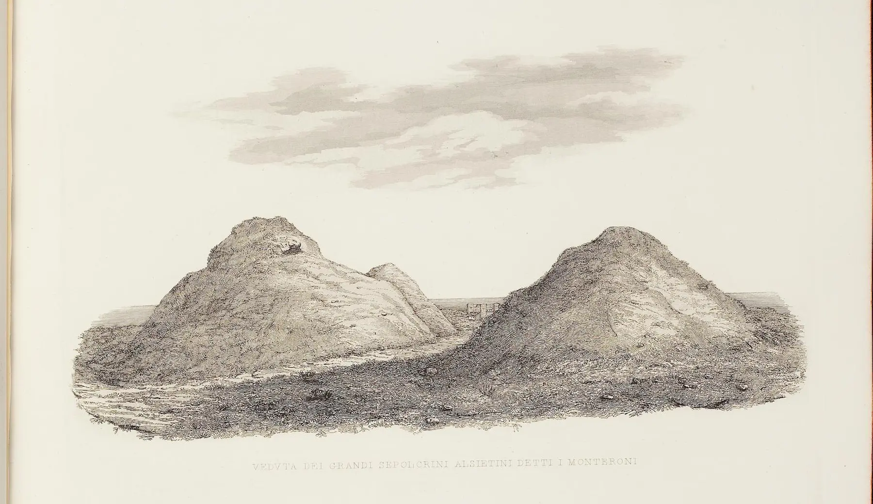
About 5.9 kilometers: the distance recorded in historical sources places Statua in the coastal corridor immediately south of the ancient colony.
SOUTHERN GATE · ROMAN ROAD AND *CASTRUM*
Statua: Ad Turres and Castrum Statua
Road, bridge, Roman station, and medieval castle: sixteen centuries of passage along the Via Aurelia converge at the Fosso Cupino.WhereVia Aurelia km 32.5 · Fosso Cupino · Palidoro area
Period2nd century BC–14th century
AccessProtected area · no regular opening
THE SITE AT A GLANCE
A travel hub that has survived across different strata.
Statua occupies a crucial passage along the ancient Via Aurelia, near the Fosso Cupino stream and the junction of the road leading to Caere. Itinerary sources place Ad Turres here—a waystation along the coastal route; not an autonomous city, but a hub equipped for travel, trade, and road control.
Between the 2nd century BC and the Imperial Age, the site featured a paved road, a bridge, residential and thermal buildings, a circular mausoleum, and a settlement laid out along the route. A marine-themed mosaic from Casal di Statua—now housed at Villa Giulia—reveals the high quality of at least one of the complex's Roman structures.
In the medieval period, the high ground overlooking the bridge was fortified. *Castrum Statua*—documented between the 12th and 13th centuries and abandoned by the end of the 14th century—still retained two towers at the beginning of the 20th century. The bridge and towers disappeared in 1944; photographs by Giuseppe and Francesco Tomassetti now serve as an irreplaceable record.
IMAGES, DOCUMENTS, HYPOTHESES
Two photographs preserve what the war erased.
Authentic sources from 1910 are presented alongside visualizations that are explicitly editorial in nature. This allows the history to be viewed without turning a reconstruction into a fake photograph.
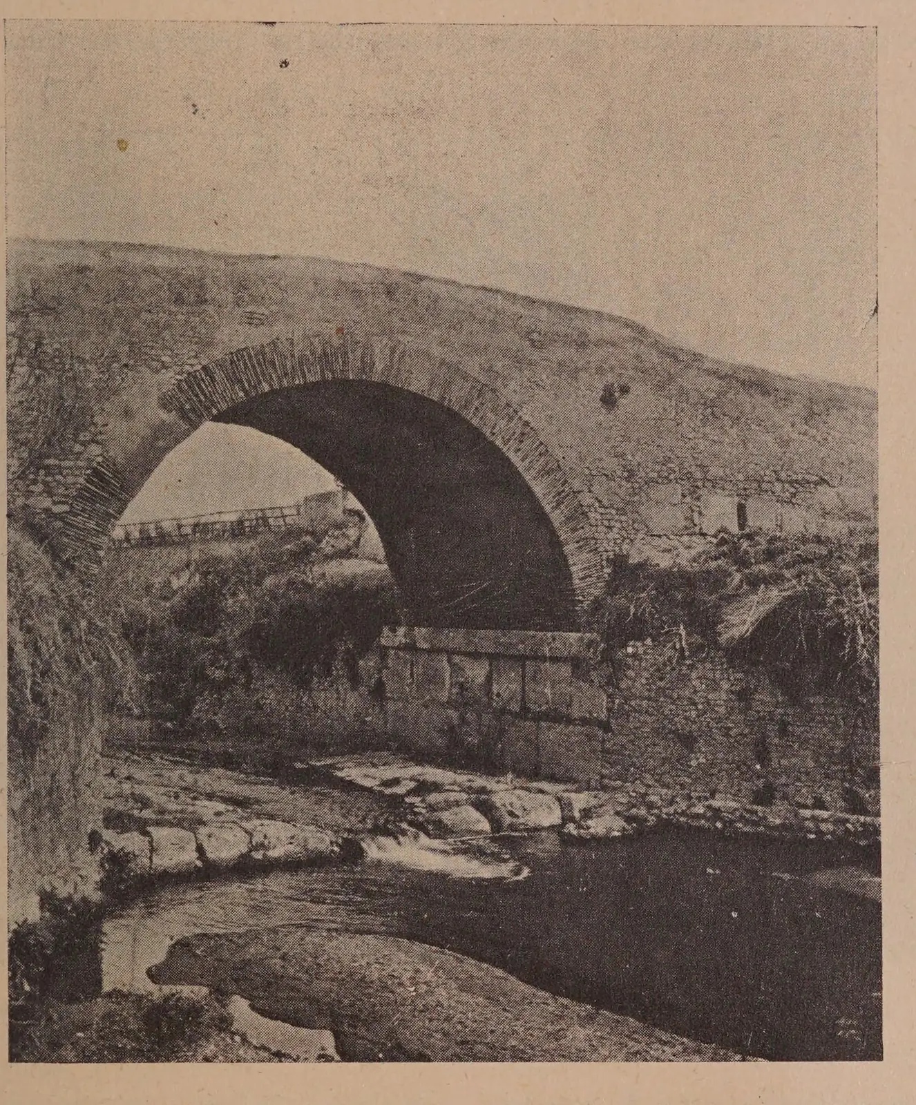
The Ponte di Statua before its destruction
The large arch spanned the Cupino stream, resting on Roman travertine foundations. The masonry, brickwork, and restoration work revealed a structure that had undergone numerous repairs over the centuries.
G. and F. Tomassetti · fig. 115 · Getty Research Institute / Internet Archive · public domain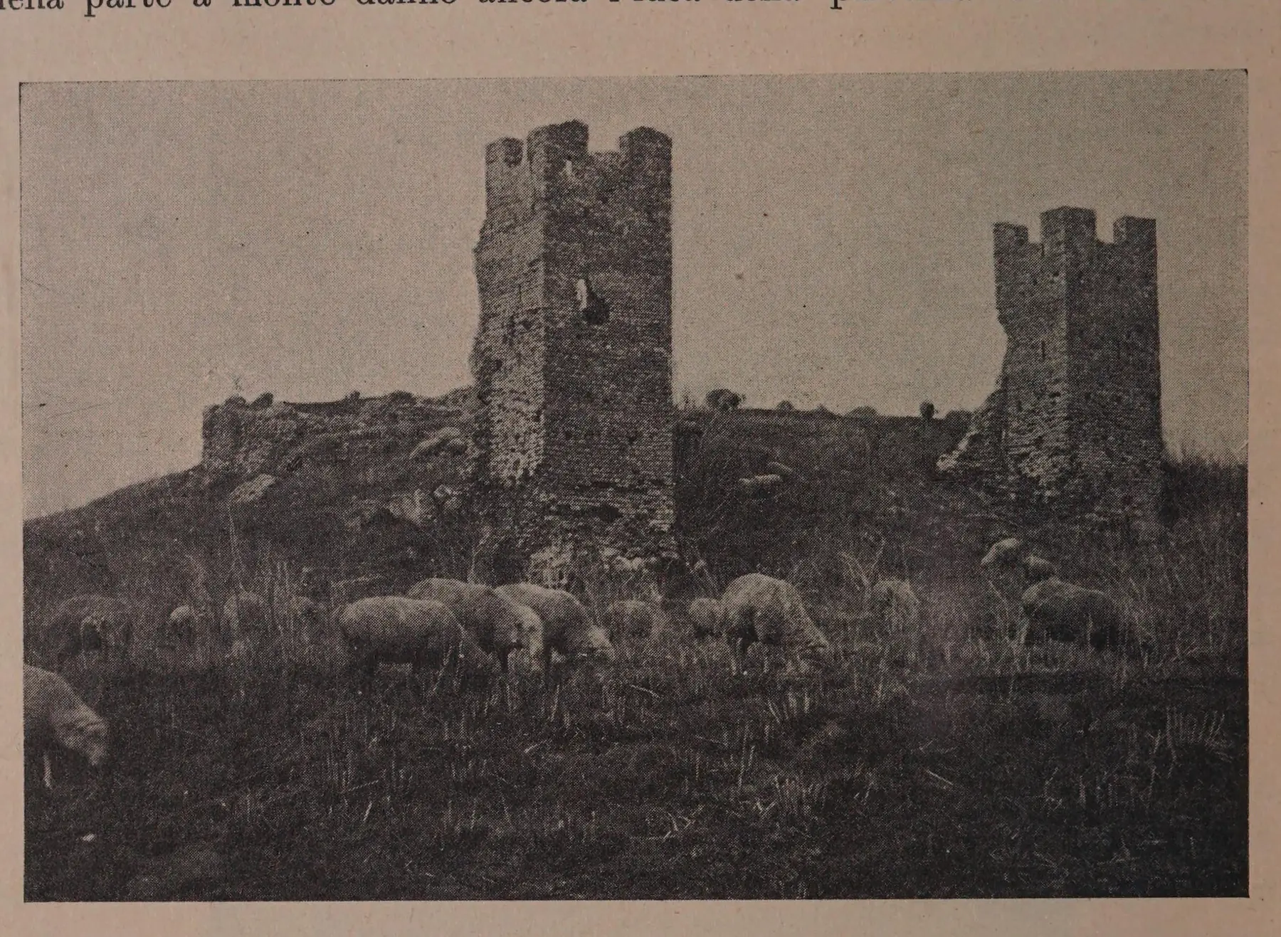
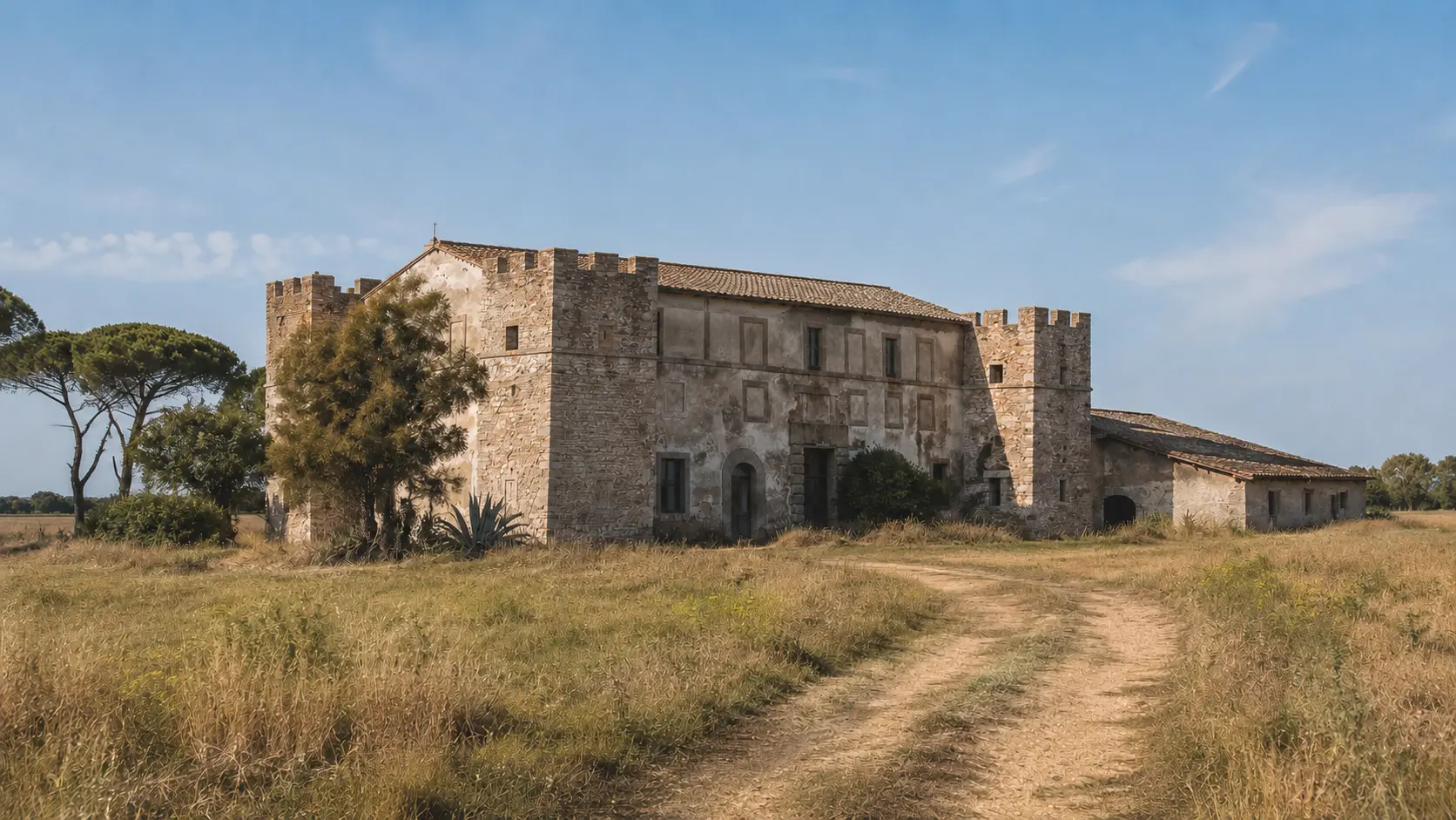
The two towers still standing
Tomassetti describes them as square, approximately three meters wide and nearly eight meters high. The photograph also shows the low masonry walls and the pastoral landscape surrounding the hill.
G. and F. Tomassetti · fig. 116 · Getty Research Institute / Internet Archive · public domain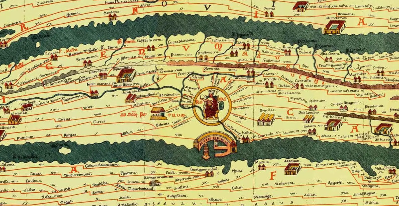
Turris in the Roman road network
The name appears along the road network west of Rome, within the same corridor as Alsium and Pyrgi. The map is not geographical in the modern sense; it primarily represents relationships and distances.
Konrad Miller · Tabula Peutingeriana · Wikimedia Commons · public domain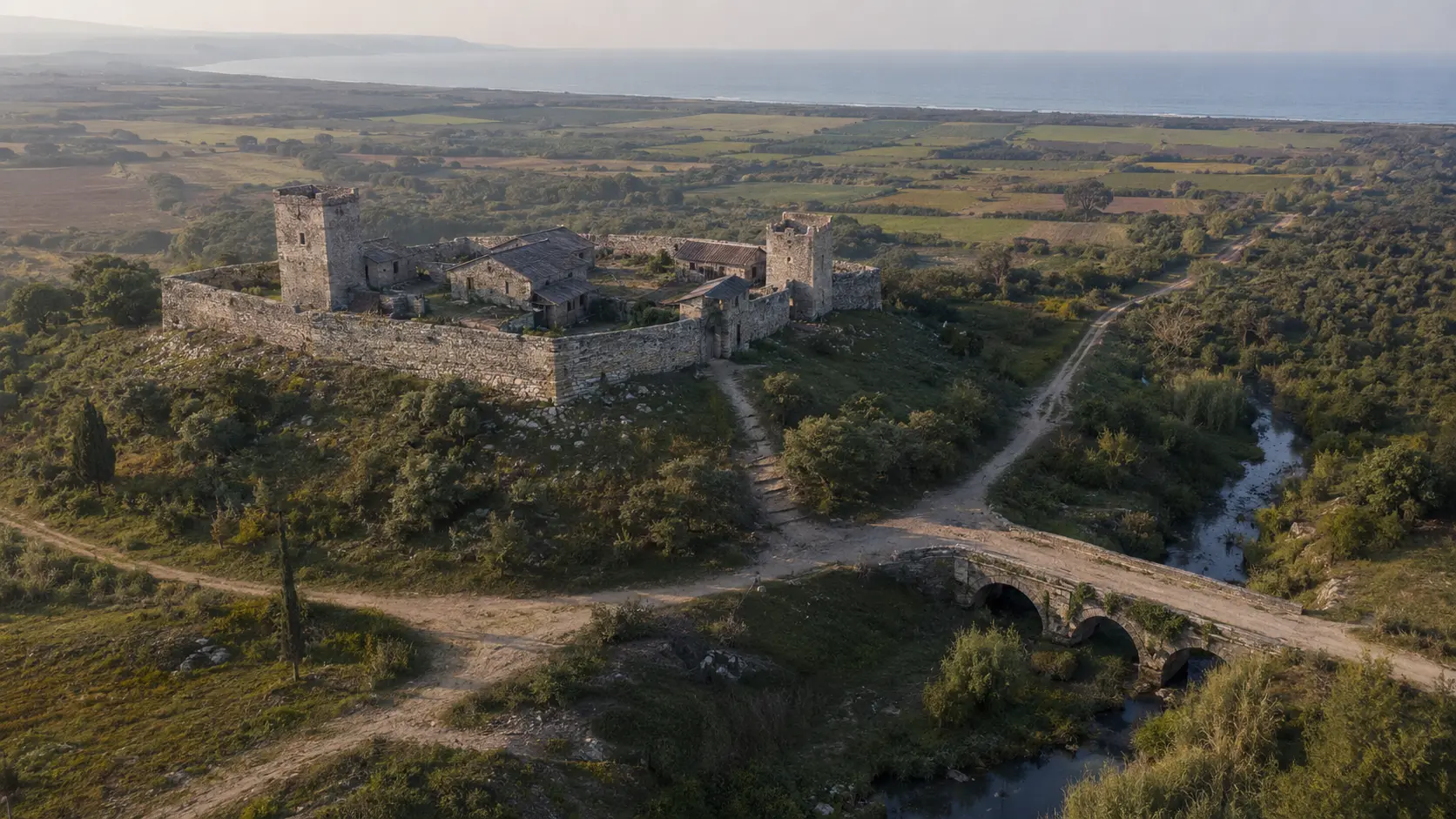
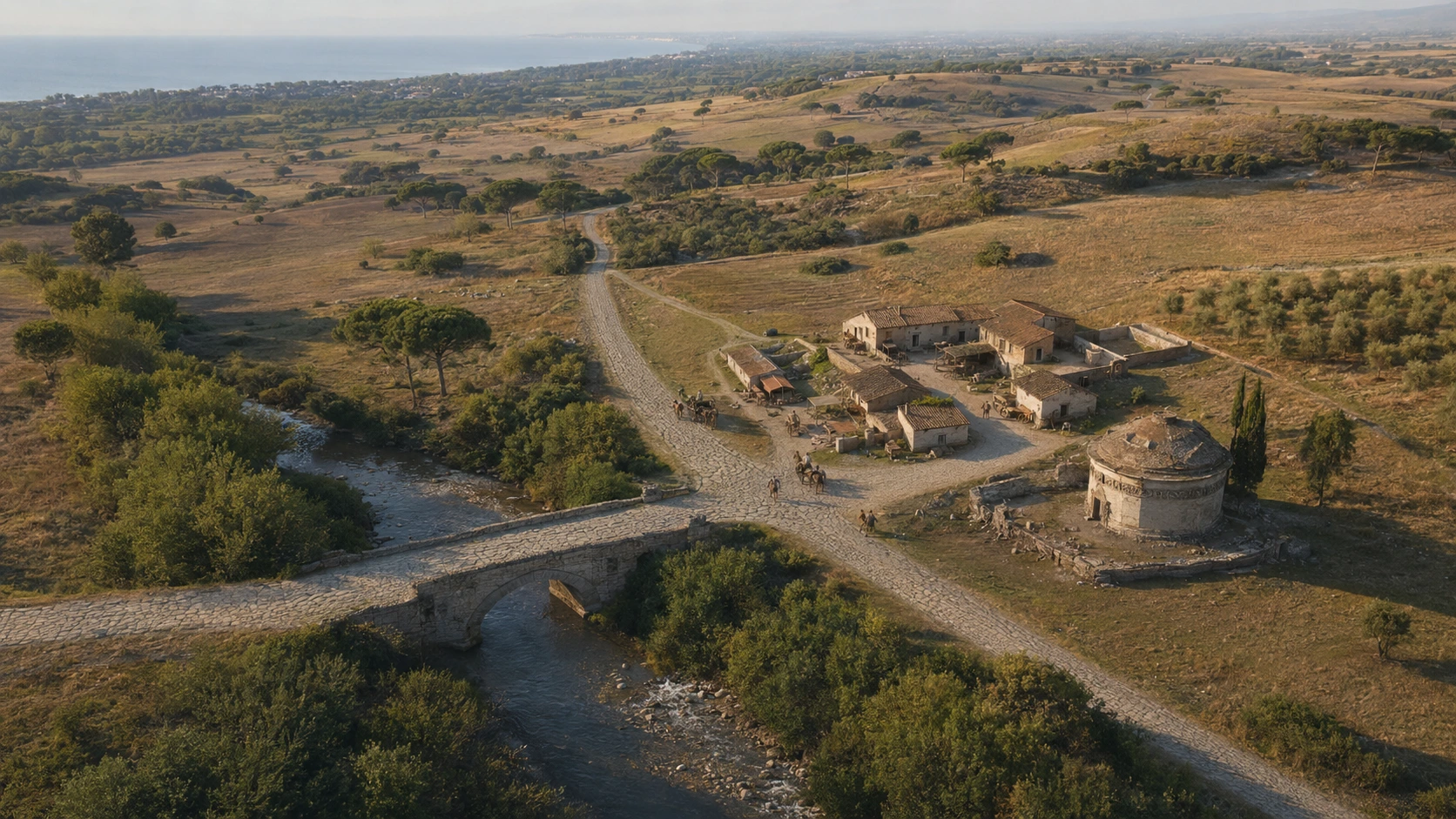
The *castrum* above the bridge
The dominant position and the two towers are based on historical sources. The complete perimeter, roofs, internal buildings, and the appearance of the bridge are hypothetical: this is an evocative depiction, not an archaeological survey.
LADISPOLI.IT editorial visualization · acknowledged reconstruction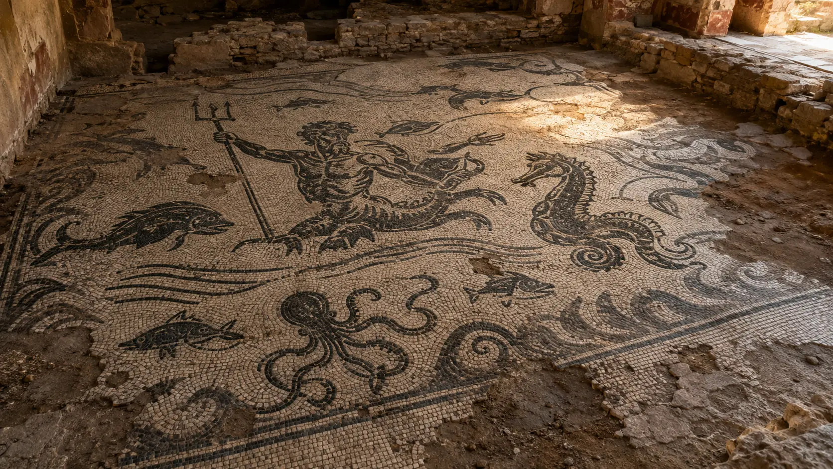
Triton, fish, and octopus from Casal di Statua
The TESS record documents a two-tone floor with a marine theme from the site. The image evokes its motifs and technique but does not reproduce the original mosaic housed at Villa Giulia.
LADISPOLI.IT · original visualization based on description TESS 16771Distances and clues
The milestones identifying the station.
Ancient itineraries, the paved road, and the crossing of the Cupino stream all point to the same topographical interpretation. Distances are given in Roman miles and converted here for reference purposes only.
Approximately 14.8 kilometers along the Via Aurelia, following the sequence of ancient stations.
About 17.8 kilometers separate the station from the northernmost Caeretan port.
The Ponte di Statua is located near the crossing of the Fosso Cupino and the junction for Ceri.
- 01 · ITINERARIESThe name online
Itinerary sources record *Ad Turres* and the distances to neighboring stations, providing the primary basis for identification.
- 02 · ARCHAEOLOGYThe road on the landscape
Stone paving, buildings, thermal baths, a mausoleum, and various materials confirm organized activity at the site from the Republican era to Late Antiquity.
- 03 · ARCHITECTUREThe bridge in phases
Roman travertine blocks, later masonry additions, and a 1910 photograph reveal a transformed structure, not one that has remained unchanged.
READING THE SITE
Five core themes, from the journey to defense.
Statua is not a single ruin. It is an archaeological landscape comprising a road, a river crossing, service buildings, monuments, and a medieval fortification.
- 01VIA AURELIA
Junction and stone paving
The route coming from Rome crossed the Cupino stream and connected to the road network leading to Caere.
Archaeological evidence · undeveloped site - 02FOSSO CUPINO
Statua Bridge
The foundations, made of large travertine blocks, date back to the Roman phase; the superstructure was reworked and rebuilt several times.
Protected ruins · no visitor path - 03ROMAN STATION
*Mansio*, villa, and thermal baths
Residential and thermal areas, mosaics, and structures flanking the road indicate a complex layout, not merely a simple waystation.
Archaeological structures · property rights and access restrictions to be respected - 04Roadside
Circular mausoleum
A concrete funerary core, previously described by Tomassetti, monumentalized the route near the bridge.
Archaeological remains · viewing only from designated areas - 05HILL
Castrum Statua
The medieval fortification controlled the road and the crossing point. Of the two towers photographed in 1910, the historic structures no longer stand today.
Protected area · topographic reconstruction
ESSENTIAL STEPS
The history,
in order.
Confirmed dates, archaeological phases, and traditions are presented for what they truly represent.
- 01
The station takes shape
The junction along the Via Aurelia took shape during the Middle Republic near the bridge and the turn-off toward Caere.
quadro archeologico - 02
The monumental phase
Villa, baths, mosaics, mausoleum, paved road, and bridge define the complex's period of greatest structural complexity.
evidenze archeologiche - 03
A Late Antique outpost
The location remains a key point in the road network even after the collapse of imperial structures.
continuità attestata - 04
*Castrum Statua*
A fortification was built on the hill to control the bridge and traffic along the Via Aurelia.
fonti e resti medievali - 05
A castle already in a fragile state
Sources record it as being partly in ruins, within a history of ecclesiastical ownership and territorial disputes.
documentazione medievale - 06
Abandonment
The *castrum* loses its function and never again becomes a permanent settlement.
limite cronologico - 07
Tomassetti photographs the bridge and towers
The images published in the *Campagna Romana* section document the standing structures that were still visible prior to the destruction that occurred in the 20th century.
fonte fotografica - 08
The War Obliterates the Standing Structures
During the German retreat, the bridge was demolished; the two medieval towers also disappeared that same year.
evento documentato - 09
Archaeological preservation
The area is placed under protection due to its historical and archaeological significance.
provvedimento MiC - 10
The roadside milestone
A columnar element, interpreted as a possible milestone, adds a new clue to the interpretation of the site's road network.
interpretazione archeologica
WHAT TO OBSERVE
Reading the site,
detail by detail.
The paving stones of the Via Aurelia
The ancient paving gives a tangible form to the route described in historical itineraries and links the various archaeological sites.
Roman travertine and medieval additions
Two courses of large blocks and the arch's springing point belong to the ancient structure; brickwork, mortar, and masonry reveal subsequent restorations.
More than just a *mansio*
Baths, mosaics, and residential areas suggest a site capable of accommodating travelers and commercial activities along the road.
The circular mausoleum
The monumental tomb provided visibility for a family or owner at the point where travel slowed down near the bridge.
A sea of black and white tesserae
A Triton, marine animals, fish, and an octopus make up the mosaic from Statua, now housed at the National Etruscan Museum of Villa Giulia.
The *castrum* towers
Square-shaped and crenellated, and built from limestone, flint, and tuff, they dominated the passageway until their destruction in 1944.
BEFORE GOING
Understanding the site without turning it into a public destination.
Statua is a protected archaeological site, but it lacks a ticket office, regular opening hours, or an organized public route. Its location near the Via Aurelia and land that is not freely accessible requires particular caution.
Do not enter private property, do not cross fences, and do not stop along the roadway. The map is intended to provide context and does not constitute an invitation to enter. For visits, surveys, or filming, please contact the relevant preservation authorities and the property owners.No visiting hours, visitor services, or equipped archaeological itineraries are published.
Avoid making impromptu stops or standing on verges or spots exposed to traffic; observe only from safe public areas.
Do not move materials, do not use drones without authorization, and report any issues to the relevant authorities.
CONSULTABLE SOURCES
To learn more,
and verify.
This first edition organizes the most solid information. Individual pages may be expanded with documents, surveys, and archival photographs.
PROTECTION AND ARCHAEOLOGICAL CONTEXT
General report on archaeological assets
Ministry of Culture · Lazio RegionContextualization of Ad Turres—including the road, bridge, villa, baths, mausoleum, and *castrum*—from the Republican era to the Middle Ages.
Open the source ARCHAEOLOGICAL STUDYAd Turres on the ancient Via Aurelia
Flavio Enei · Studi Romani · 1991Summary of findings, interpretation of the *statio* (waystation), and relationship with ancient road networks.
Open the source ARCHAEOLOGY OF THE BRIDGEThe Statua Bridge on the Via Aurelia
Corrado Alvaro · 2012Analysis of the masonry and construction phases, and a proposed reconstruction of the bridge.
Open the source HISTORICAL AND PHOTOGRAPHIC SOURCEThe Roman Countryside · Via Aurelia
Giuseppe and Francesco Tomassetti · Vol. II · 1910Description of the bridge, the mausoleum, and the two towers, with photographs taken prior to the destruction of 1944.
Open the source ANCIENT ITINERARIESTabula Peutingeriana · Tower
Catholic University of Eichstätt-IngolstadtRecord regarding the station and the connections documented in the Roman road map.
Open the source MOSAICBichrome mosaic with a marine theme
TESS · record 16771 · University of PaduaScientific catalog of the Statua mosaic housed in the nymphaeum of Villa Giulia.
Open the source LOCAL HERITAGELadispoli: history and archaeology
Municipality · GATC · GAR · 2024Informational record on the statue, placed within the context of archaeological sites linked to the history of Ladispoli.
Open the source LANDSCAPE PROTECTIONDeclaration of significant public interest
Official Gazette · 19 October 2022Measure concerning the agricultural and archaeological landscape of the Palidoro area and the historic Via Aurelia corridor.
Open the source DISCOVER THE SECTORAll the places of memory.
Open the complete catalog of monuments, archaeological sites, and historical landscapes.
Open the sectorCONTINUE THE ROUTE