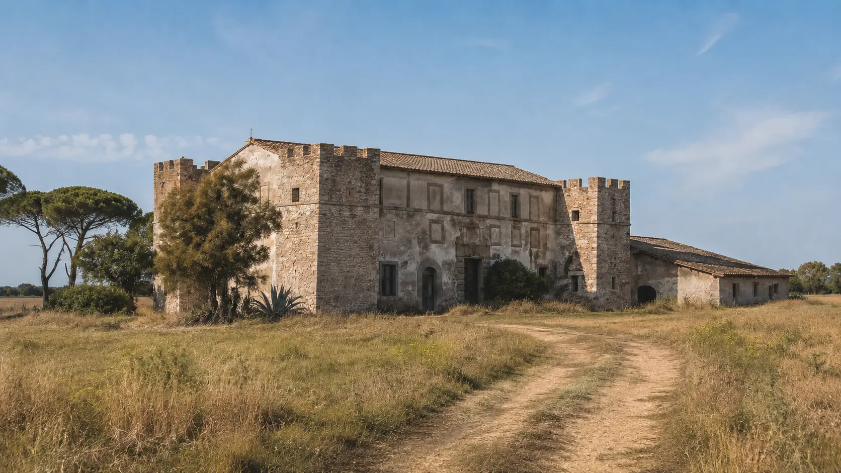
The large burial mound
The surviving structure still conveys the monumental scale of the Etruscan funerary landscape.

Monteroni · Etruscan necropolis
THE SITE AT A GLANCE
The necropolis developed along what is now Via dell’Acquedotto di Statua, a road that preserves the memory of the ancient Via Aurelia’s route. From the 7th century BC, limestone ridges were transformed into large burial mounds; between the 6th and 5th centuries, the burial ground expanded with numerous tombs, and some sections remained in use even during the Roman era.
Excavations initiated in 1839 by Teresa de Rossi Caetani unearthed Orientalizing grave goods that were subsequently dispersed. Luigi Canina produced drawings of views, plans, and proposed reconstructions; between 1964 and 1968, the University of Rome produced the first modern scientific documentation, prior to the severe damage caused in the 1970s by quarrying, ploughing, and other interventions.
VIEW, SURVEY, HYPOTHESIS
Canina’s plates are extraordinary, but they must be interpreted methodically: they document what the author actually saw and measured, alongside idealized reconstructions explicitly identified as such.
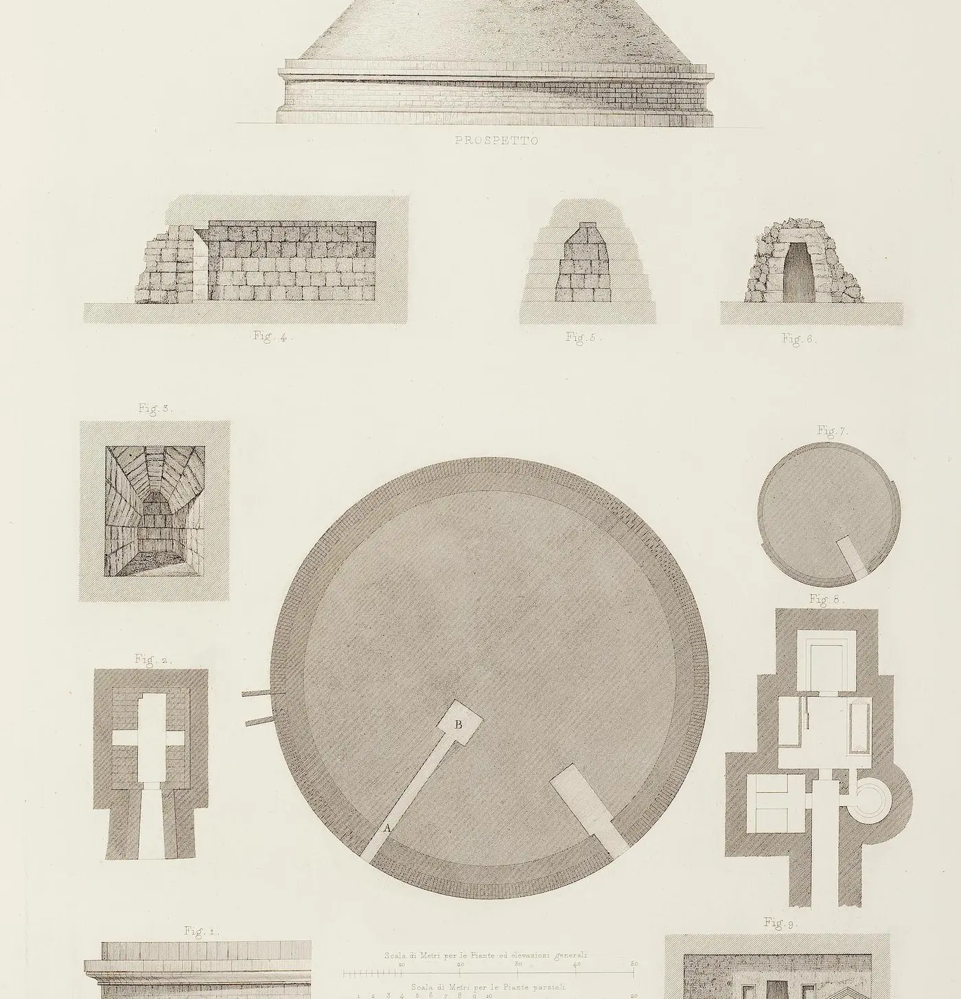
Plate XL brings together the large circular perimeter, the corridors, the chambers, and various masonry details. It is a valuable historical survey that should be compared with modern measurements before being used as a basis for a 3D model.
Luigi Canina · Plate XL · Public Domain Mark · UB Heidelberg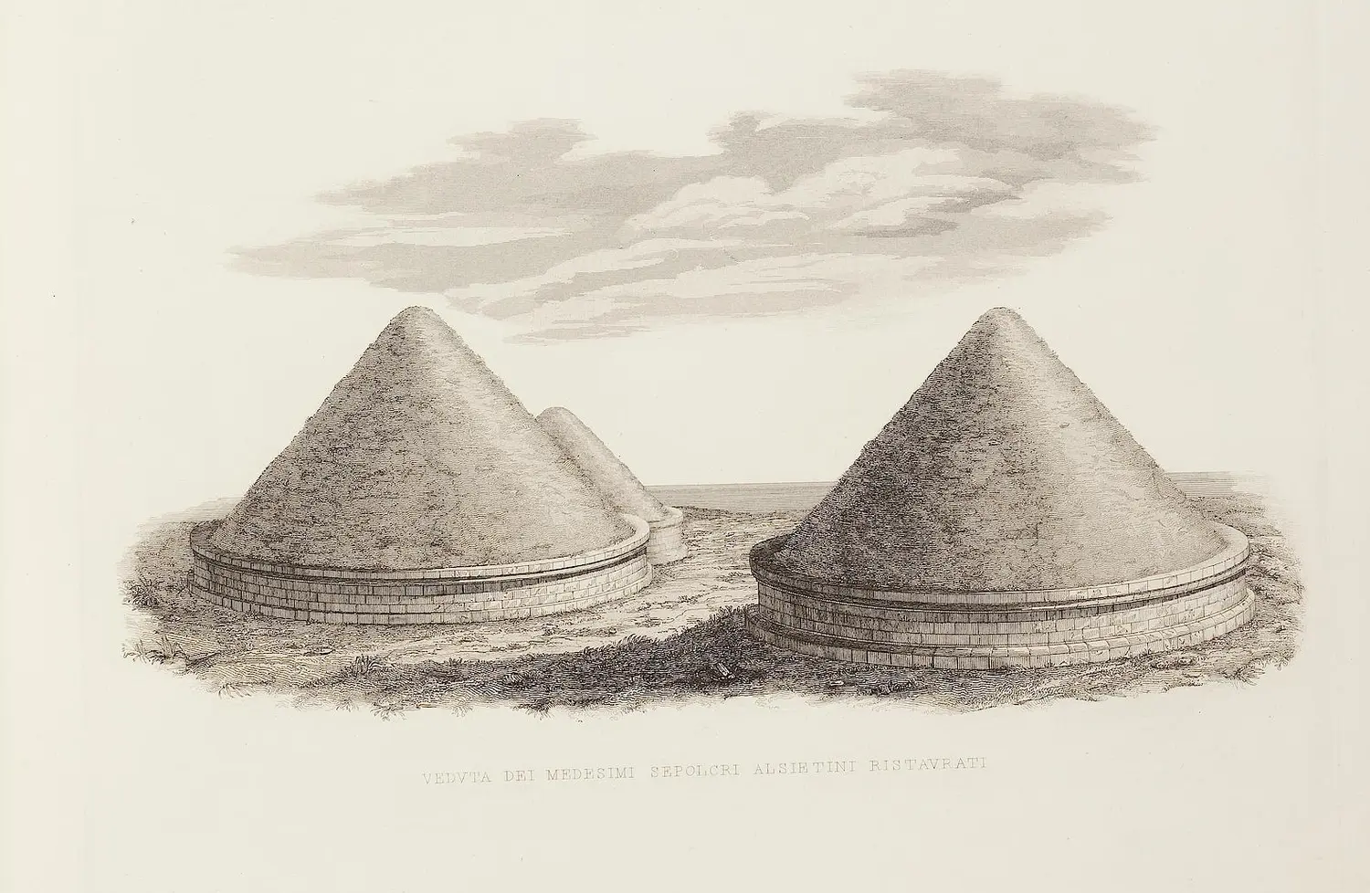
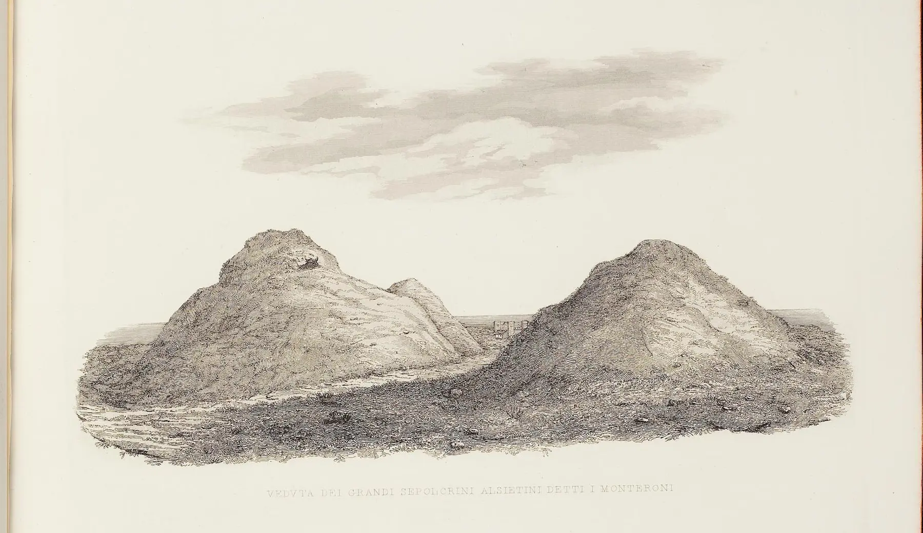
Regular bases and conical profiles are part of the author’s proposed reconstruction. The image does not depict the original Etruscan appearance and should not be presented as a certainty.
Luigi Canina · Plate XXXIX · Public Domain Mark · UB Heidelberg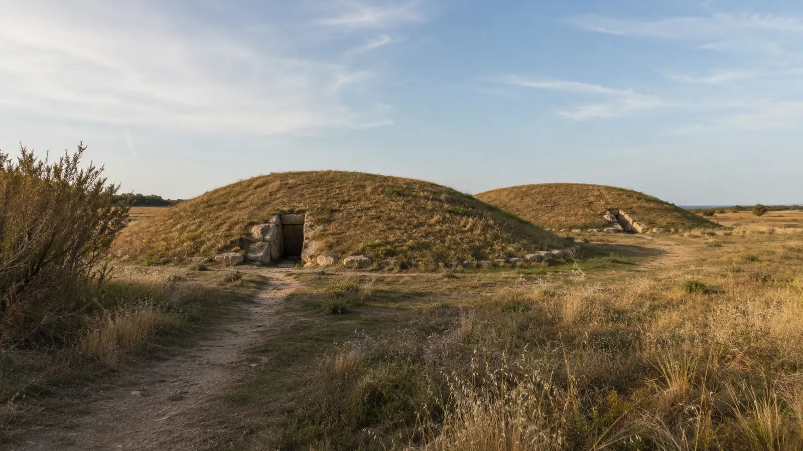
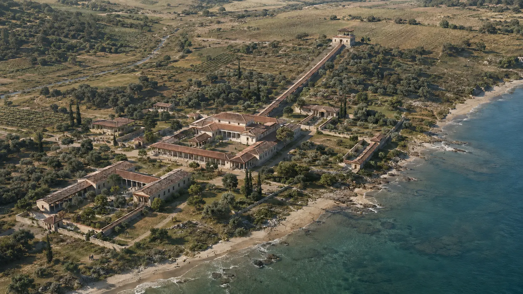
This view evokes the logic of the funerary landscape but does not depict the site's current state, nor does it faithfully reconstruct the Monteroni tombs.
LADISPOLI.IT editorial visualizationESSENTIAL STEPS
Confirmed dates, archaeological phases, and traditions are presented for what they truly represent.
Monumental tombs—among the largest in the area—transform the limestone ridges into visible landmarks in the landscape.
fase orientalizzanteNew tombs are arranged around the tumuli along the route between Caere and the sea.
sviluppo archeologicoCapuchin-style tombs and funerary monuments reuse certain areas near the Via Aurelia.
frequentazione documentataTeresa de Rossi Caetani sponsors the exploration of the larger tumulus; the Orientalizing grave goods discovered there are subsequently dispersed.
scavi storiciThe British traveler describes the construction site and her own experience while touring the Etruscan tombs.
testimonianza editaViews, plans, and sections document the complex; the ‘restoration’ images remain 19th-century reconstructions.
fonte grafica da interpretareThe Institute of Ancient Topography at the University of Rome documented the site prior to the major subsequent transformations.
ricerca documentataExtraction and agricultural activities have severely damaged the area, though some structures remain discernible.
trasformazione contemporaneaWHAT TO OBSERVE
The surviving structure still conveys the monumental scale of the Etruscan funerary landscape.
Corridors and burial chambers transformed a mound of earth into a structure dedicated to family memory.
The necropolis occupied a strategic corridor between the Etruscan city, the ancient Via Aurelia, and the coast.
Hamilton Gray and Canina allow for a comparison between the 19th-century appearance and what remains today.
BEFORE GOING
There is no established archaeological route with a ticket office or daily opening hours. The complex is situated in a sensitive agricultural landscape, featuring areas that are undeveloped, unsecured, or inaccessible to the public.
Use the map solely for orientation. Do not cross fences or attempt to enter the tombs; for information on guided tours, check recent announcements from the Municipality, the Superintendency, and authorized associations.The necropolis is not an archaeological park open for free public visits, nor does it publish a daily schedule.
The site is located off Via dell’Acquedotto di Statua, in the Monteroni area south of Ladispoli’s town center.
Stay on designated paths; do not climb on the mounds or touch/remove archaeological materials.
CONSULTABLE SOURCES
This first edition organizes the most solid information. Individual pages may be expanded with documents, surveys, and archival photographs.
Updated summary regarding chronology, 19th-century excavations, research conducted between 1964 and 1968, and transformations of the site.
Open the source ARCHAEOLOGICAL RESEARCHNew findings and hypotheses regarding the coastal landscape to which the necropolis may have been linked.
Open the source TERRITORIAL STUDYUpdated overview of the connections between the Caeretan hinterland and the coastal strip.
Open the source 19th-century sourceThe account of 19th-century visits and explorations in the Monteroni area.
Open the source HISTORICAL SURVEYSDigitized original volume featuring plates XXXIX and XL, dedicated to the tombs of Monteroni.
Open the source DISCOVER THE SECTOROpen the complete catalog of monuments, archaeological sites, and historical landscapes.
Open the sectorCONTINUE THE ROUTE