Approximately fifty meters by at least thirty; the northern side is buried or covered by modern buildings.
Palo Laziale · Colony, port, and villas
Alsium and the ancient port
Traces of the Roman colony survive beneath and around Palo: a large basin, a pier, substructures, and roads set within a landscape of villas facing the Tyrrhenian Sea.WherePalo Laziale · Castle and historic hamlet
Period247 BC–6th century AD
· hypothetical Etruscan phase
AccessRemains difficult to access · no standard visits
THE SITE AT A GLANCE
A Roman city at Palo. An Etruscan landing place yet to be discovered.
Alsium was a Roman maritime colony traditionally founded in 247 BC. Its center is located near Palo Laziale, in the area now occupied by the Castle and the hamlet. Inscriptions, masonry, and artifacts confirm its presence, yet do not yet allow for a complete plan of the city to be drawn.
The coastal structures point to a functional landing place rather than a monumental harbor. A large rectangular basin—interpreted as a fishpond and perhaps later adapted into a small dock—along with a curved pier, vaulted spaces beneath the houses, road sections, and reused materials, make up a system built in at least three phases starting in the late Republican period.
Etruscan Alsium presents a different issue. Recent studies consider Marina di San Nicola—located about two kilometers further southeast—to be the most convincing candidate for the pre-Roman landing site; however, the identification remains hypothetical. The Monteroni Tumuli and other sites in the *ager Alsietinus* belong to the same historical landscape, rather than to a single monument.
Literary sources describe a coastline frequented by the Roman aristocracy, featuring villas linked to figures such as Marcus Aemilius Porcina and Verginius Rufus, as well as imperial estates. These names do not justify automatically attributing an excavated villa to Caesar, Pompey, or Marcus Aurelius; the territory, city, port, and residences must be treated as distinct entities.
SCENE, ARTIFACTS, AND MAPS
Alsium: from hypotheses to evidence.
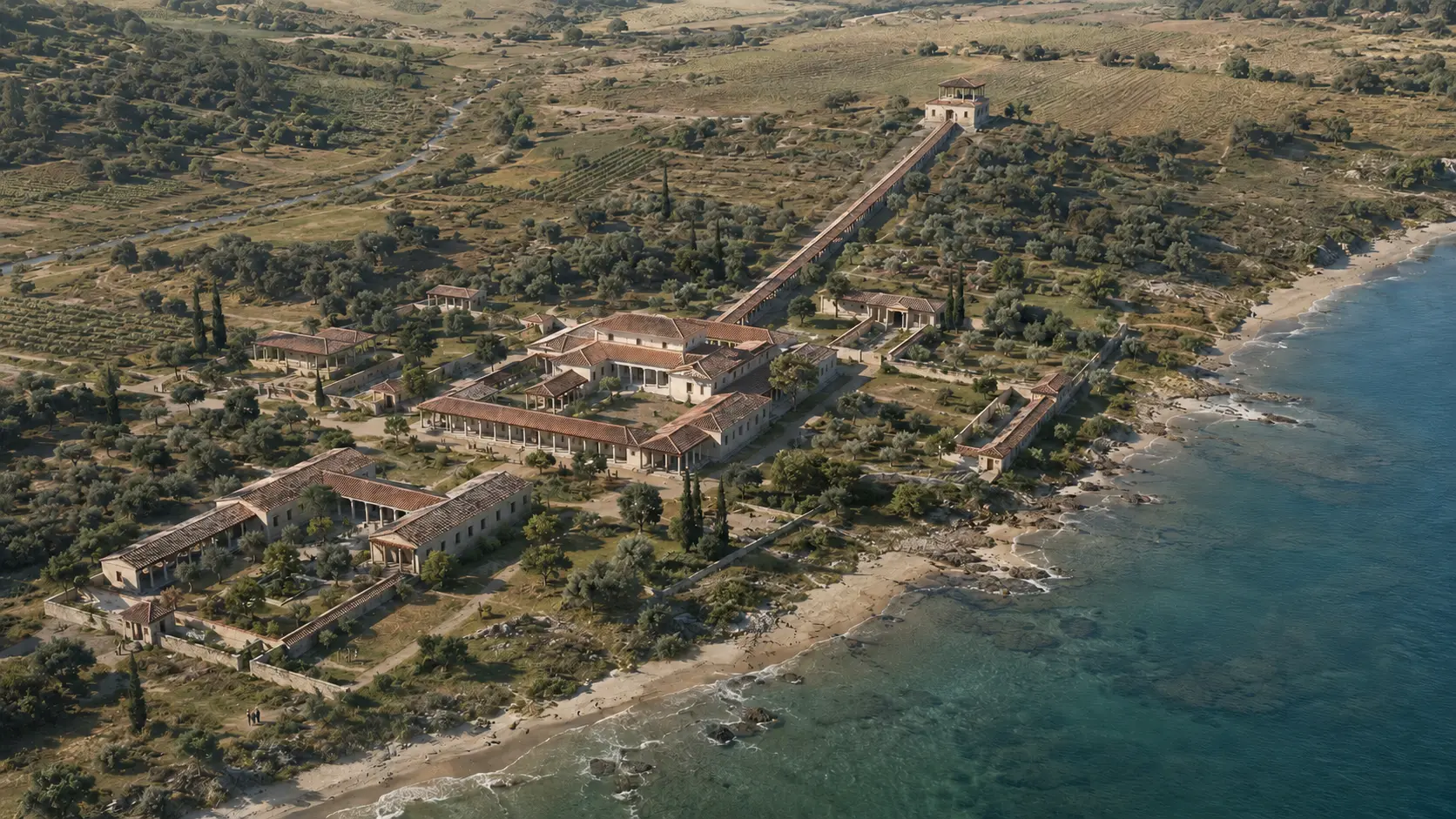
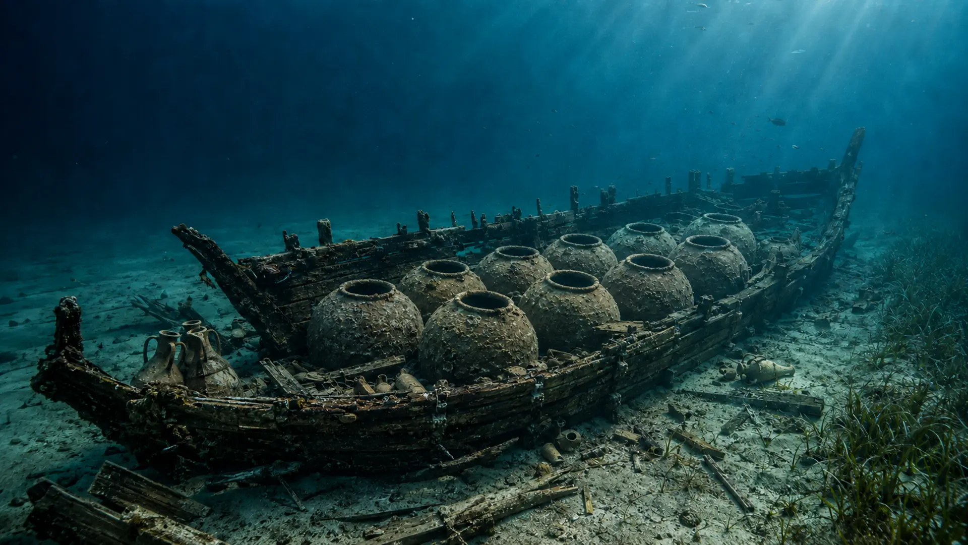
Six images clearly distinguish between the reconstruction, the actual landscape, the archaeological find, and the historical document. No modern photographs are used to create the illusion that the ancient port is still fully visible.
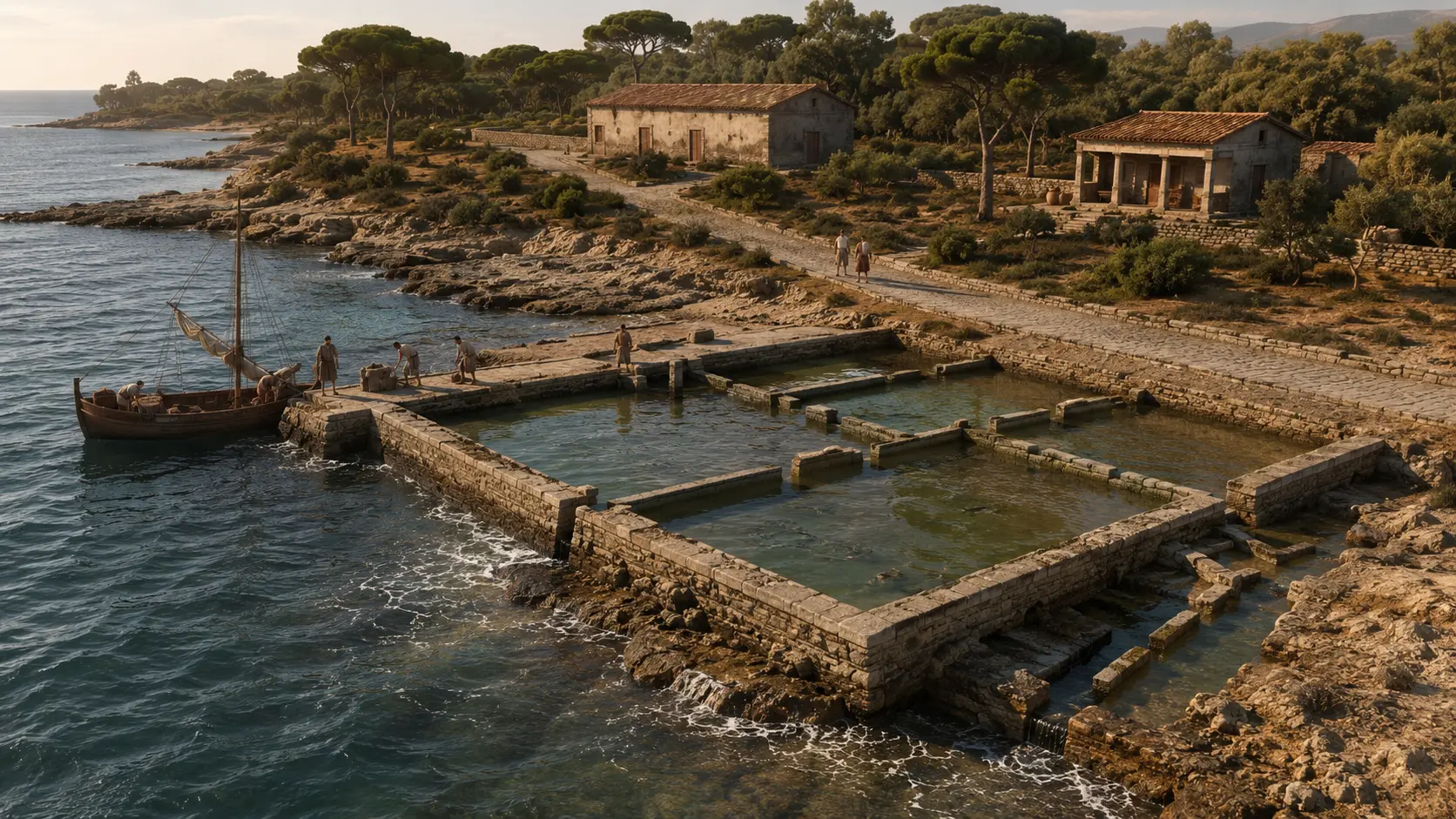
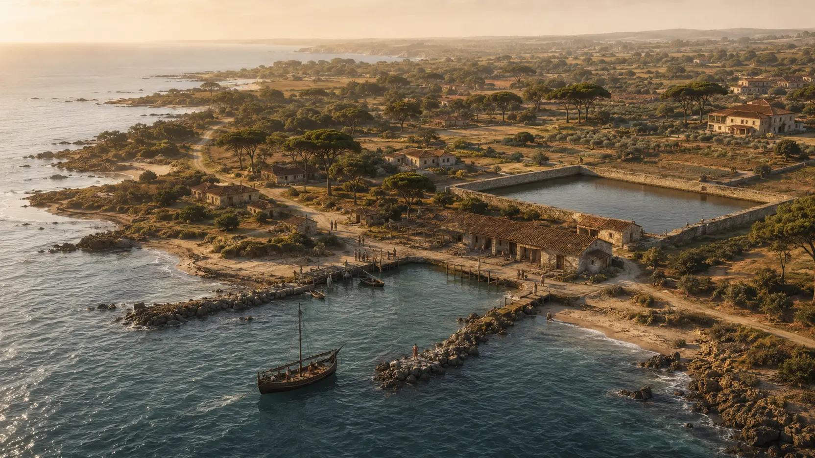
The basin: between fishing and landing
The scene visually renders the rectangular basin, canals, pier, and coastal road. The elevations, spatial divisions, boat, and landscape are interpretative; the image is neither a photograph of the remains nor a measured survey.
Original view LADISPOLI.IT · declared reconstruction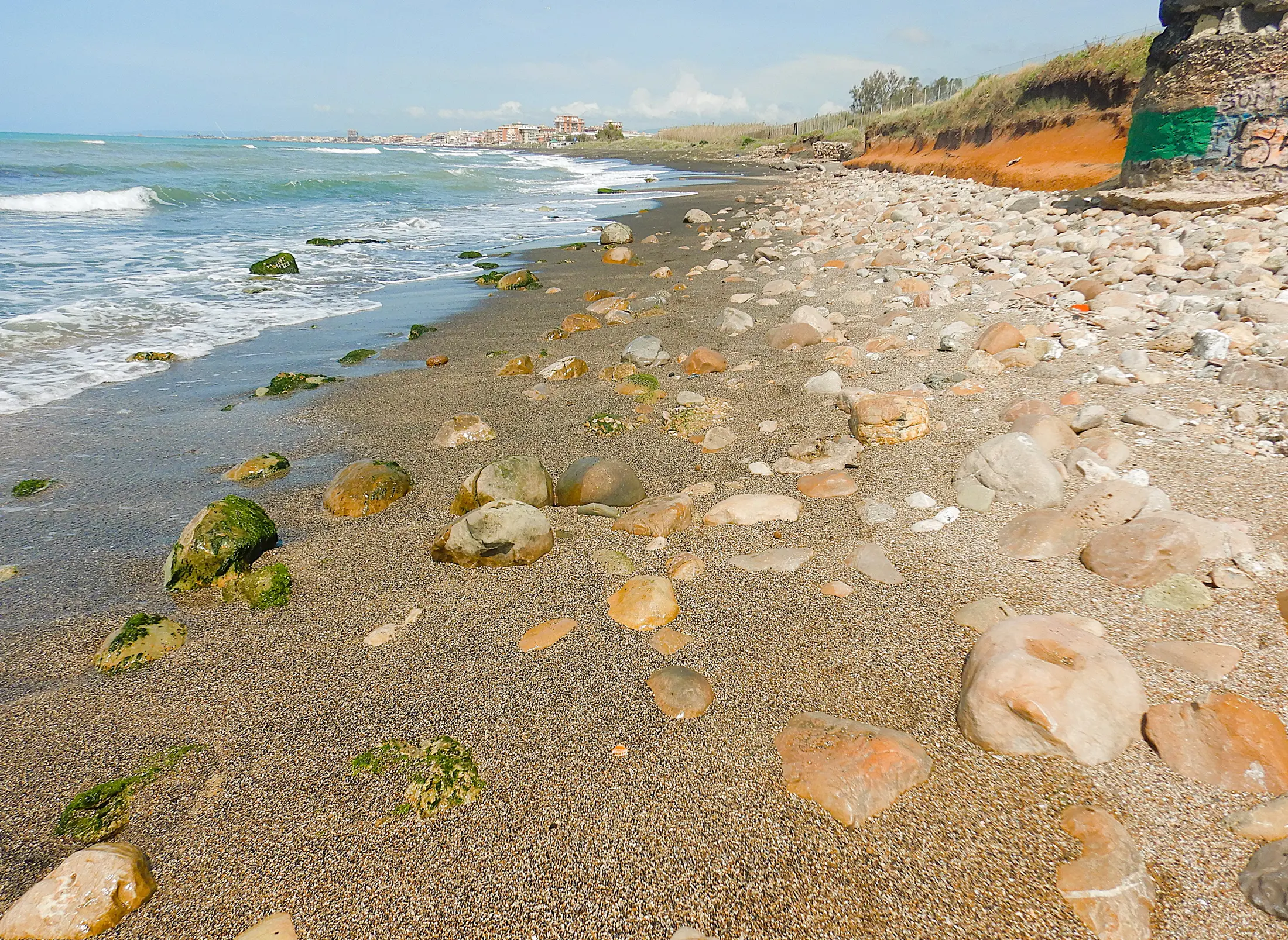
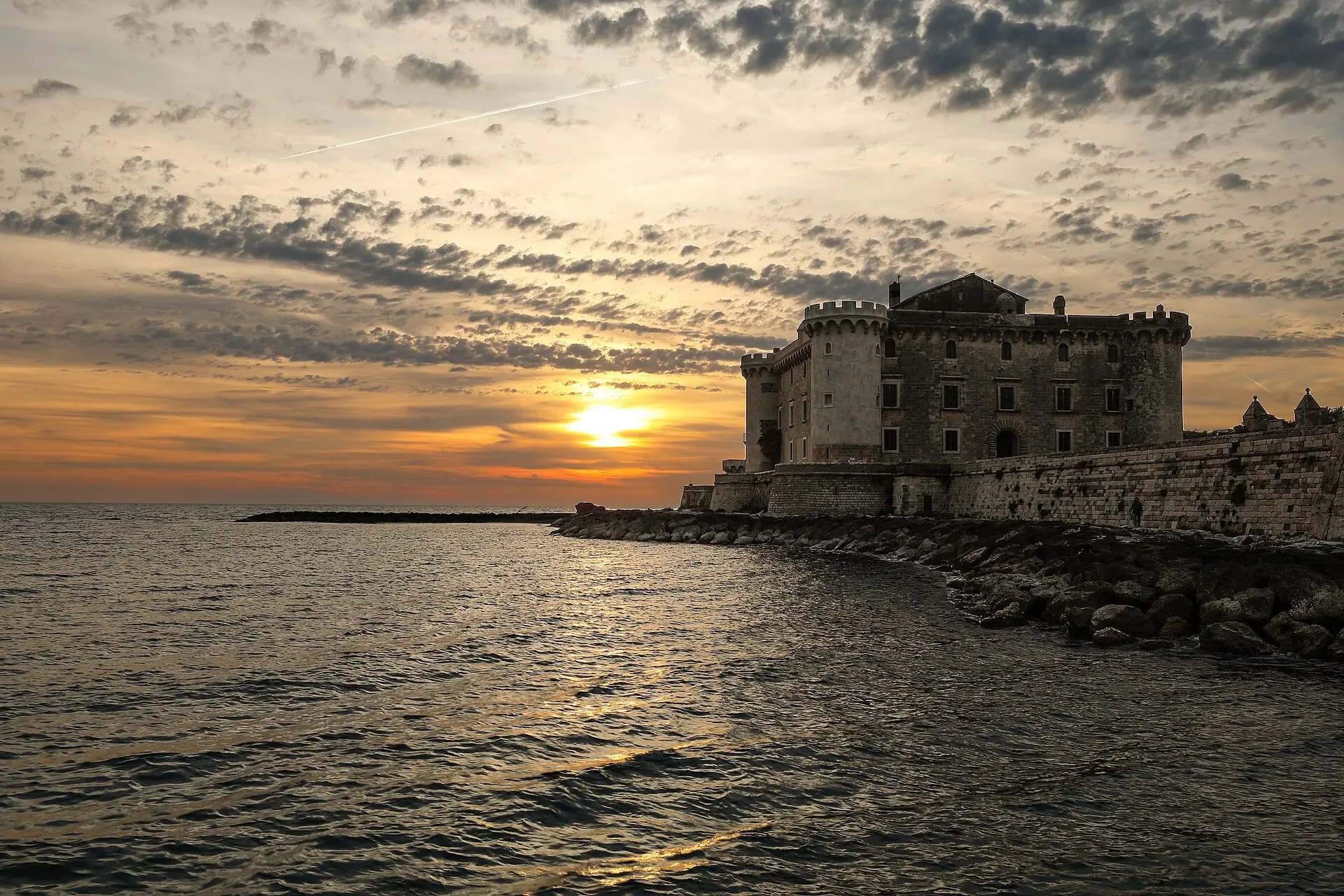
The present-day coast, without overlays
The photograph documents only the contemporary coastline. The visible outcrops are not identified as harbor structures without a specific archaeological survey.
Albarubescens · CC BY-SA 4.0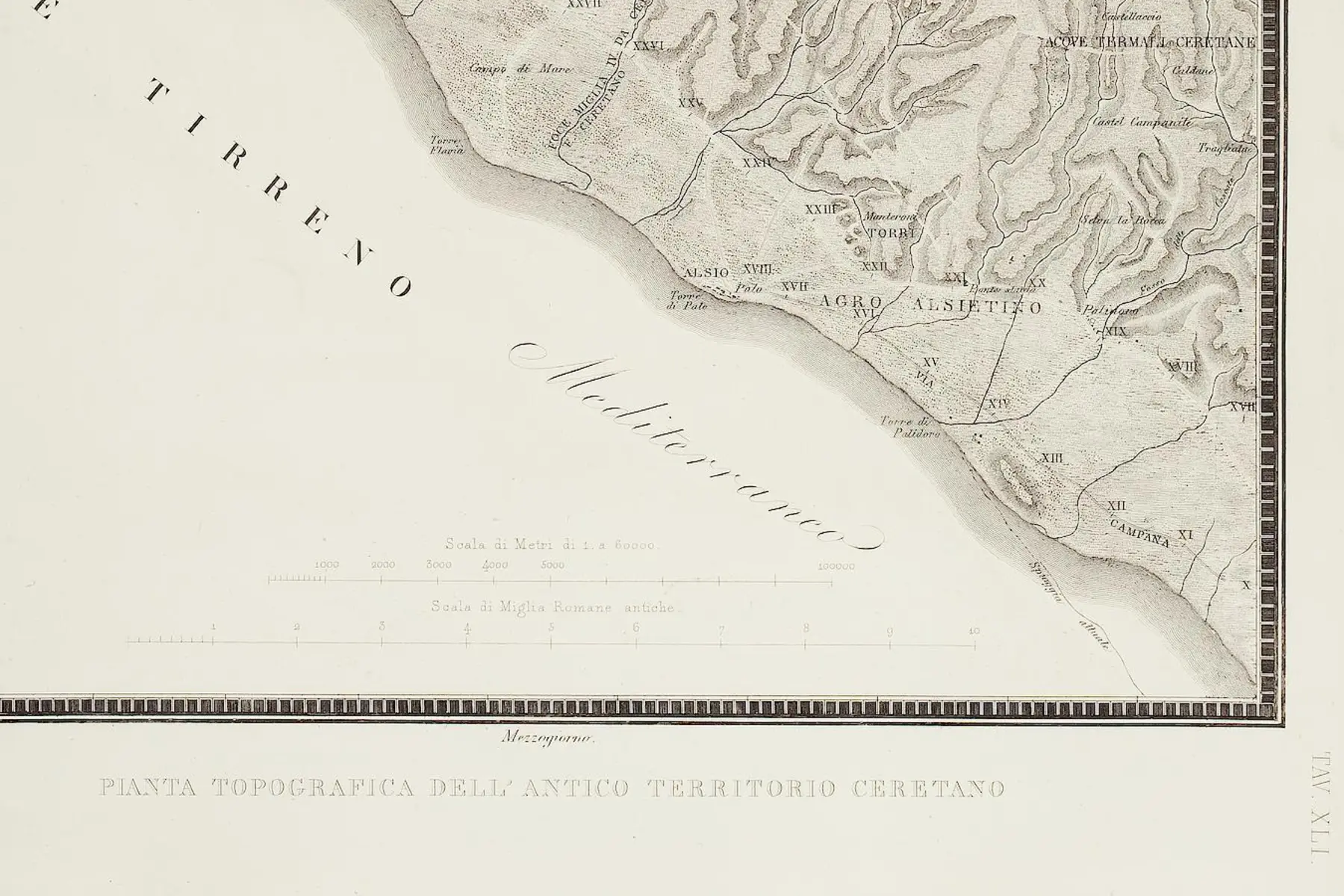
Alsium and the *Ager Alsietinus* (Alsium territory) on the map
Canina locates Alsio near Palo and illustrates the extent of the coastal territory. This is a document of 19th-century research, not an up-to-date archaeological map.
Luigi Canina · UB Heidelberg · Public Domain Mark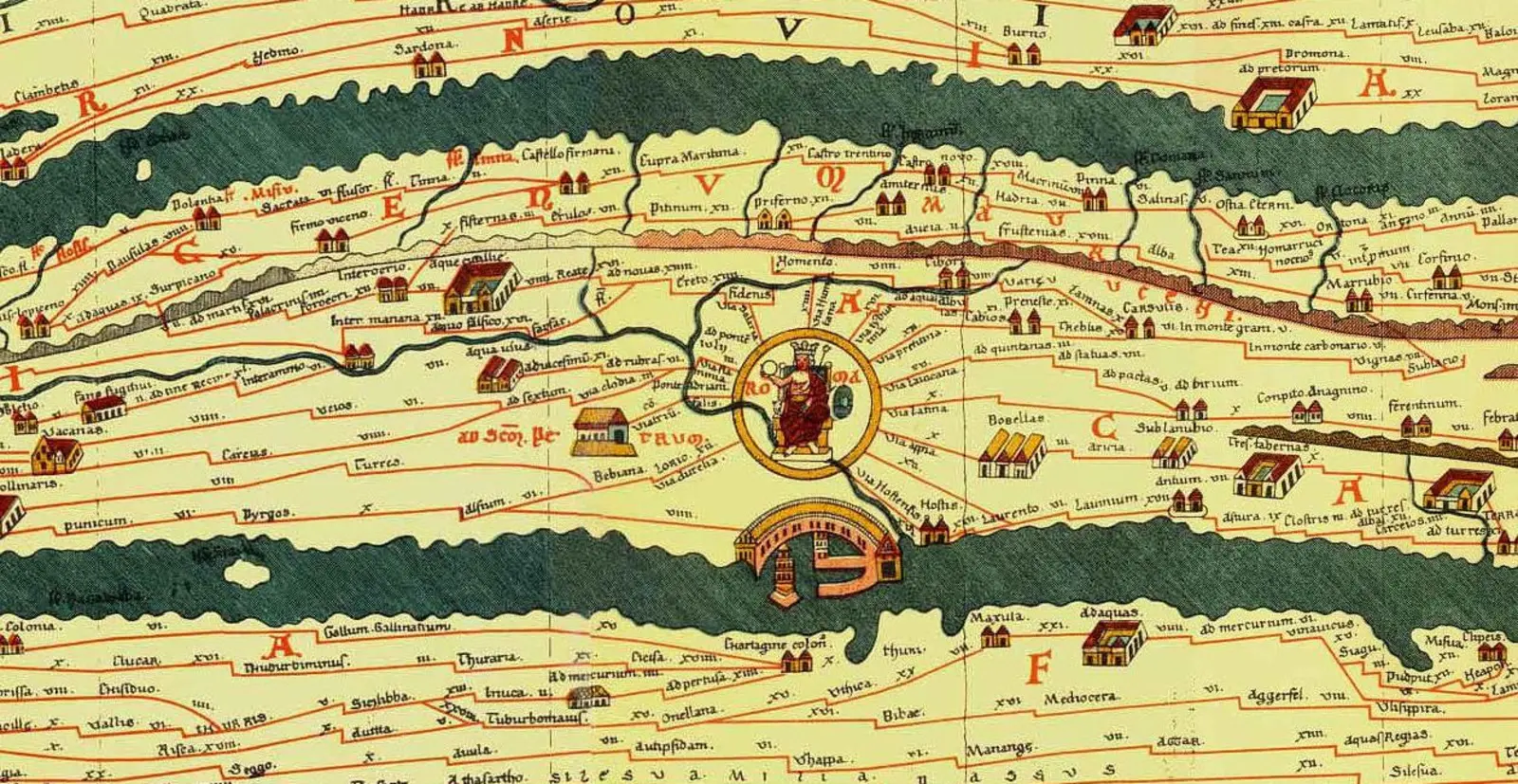
Alsium within the road network
The *Tabula* records Alsium on the coastal route between Rome and Pyrgi. The distances and the route layout represent schematic itinerary information, not a modern geographical projection.
Konrad Miller · public domain · Wikimedia Commons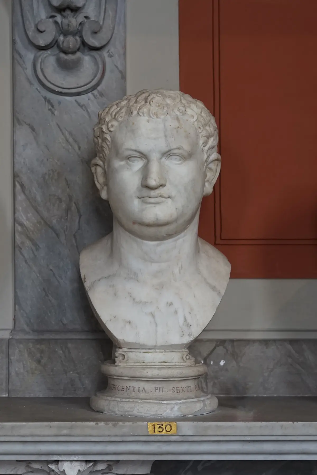
A portrait of Titus from the Palo area
The ancient head—now mounted on a modern bust—was discovered during Gavin Hamilton’s excavations at Palo. It attests to the richness of the Roman contexts in the area, rather than the specific location of a particular harbor building.
Fabrizio Garrisi · Vatican Museums · CC BY-SA 4.0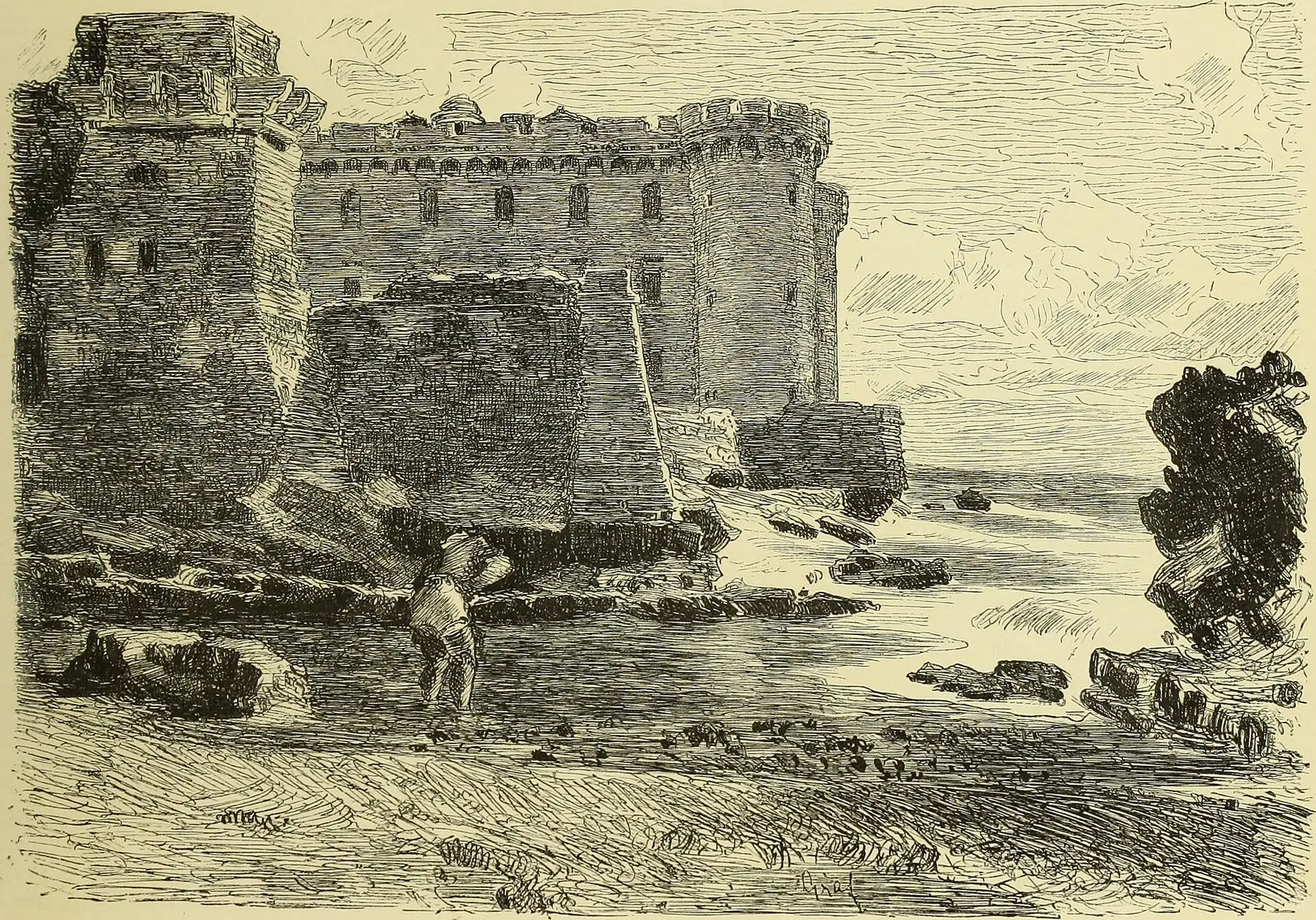
The castle atop the ancient site
The engraving depicts the coastal landscape long after the Roman city existed. It helps explain why parts of the ancient system now lie beneath ramparts, buildings, and altered stretches of the shoreline.
Internet Archive Book Images · no known restrictionsTHE KNOWN MEASUREMENTS
A port interpreted through fragments.
The published dimensions allow for a cautious reconstruction of the surviving structures. However, they are insufficient on their own to reconstruct the entire ancient coastline or the urban layout of Alsium.
Curvilinear section still visible today, featuring reticulated masonry facing and a later addition of approximately thirty centimeters.
Thickness reached locally by the phase linked to the harbor works; the initial masonry of the basin measures approximately 1.80 meters.
At least three discernible phases of transformation dating from the late Republican period onwards.
- 01Surveying the remains
The basin, pier, substructures, and masonry are described based on the sections actually observed.
- 02Separating the phases
Thicknesses, facings, and additions do not necessarily belong to a single harbor project.
- 03Outlining the hypothesis
The dock below the hamlet and another 15–20 meters of the submerged pier remain hypotheses requiring verification.
- 04Leaving the voids empty
Where excavation data or elevation measurements are missing, the reconstruction does not invent walls, piers, or public buildings.
SIX SECTIONS, NOT JUST A SINGLE MONUMENT
The archaeological geography of Alsium.
The name "Alsium" encompasses a vast territory, yet each settlement has its own distinct history, chronology, and level of historical certainty.
- 01PALO · CASTLE AND VILLAGE
The center of the Roman colony
Inscriptions and artifacts confirm the city's location near Palo; its urban layout and any potential circuit of walls remain unknown.
Scattered structures, largely inaccessible to the public - 02BENEATH THE BASTIONS
The large rectangular basin
The concrete structure is traditionally interpreted as a fishpond, perhaps later converted into a small dock.
Property and coastal strip · no regular opening - 03SEA FRONT
The curved pier
The preserved section constitutes a genuine harbor structure. Parts sketched by Lanciani in 1898 have since disappeared, and the submerged continuation remains hypothetical.
Do not approach structures located in the water. - 04Beneath the village houses
Vaulted substructures
Rooms made of *opus caementicium* may have supported storage areas or a *horreum*, but their function has not been definitively established.
Spaces not organized for visitation - 05AGER ALSIETINUS
Roads, villas, and necropolises
Posta Vecchia, Marina di Palo, San Nicola, and Monteroni make up the ancient landscape of the colony, though none of them corresponds to its harbor.
Consult the pages dedicated to individual sites - 06Marina di San Nicola
The candidate for the Etruscan landing site
Materials and geomorphology make the promontory a strong candidate for pre-Roman Alsium, though decisive topographical evidence is lacking.
Archaeological hypothesis · not a delimited port site
ESSENTIAL STEPS
The history,
in order.
Confirmed dates, archaeological phases, and traditions are presented for what they truly represent.
- 01
The Pelasgian foundation
Dionysius of Halicarnassus attributes the city to the Pelasgians led by Halesus. This is an origin story, not a verifiable historical account.
leggenda antica - 02
The problem of Etruscan Alsium
Materials and location make Marina di San Nicola a plausible candidate for the pre-Roman landing site; the identification remains open.
ipotesi scientifica - 03
The Roman maritime colony
Velleius Paterculus’s chronology places the founding of the colony near Palo in this year.
data tradizionale accolta - 04
Refusal of the exemption
Livy lists Alsium among the maritime colonies that, during Hasdrubal’s advance, requested exemption from providing troops; the Senate rejected the request.
fonte letteraria - 05
A villa that is too tall
Valerius Maximus records the residence of Marcus Aemilius Porcina in the *ager Alsiensis*—an example of the early aristocratic development of the coast.
fonte letteraria - 06
Villas and early works in the basin
The residential landscape develops as the coastal basin and associated structures undergo their earliest recognized phases of construction.
cronologia archeologica - 07
Caesar expected at Alsium
Cicero discusses Caesar’s anticipated arrival at his villa and recommends disembarking at Ostia; this serves as evidence of the landing site's use, not as a technical description of the harbor.
Ad familiares 9.6 - 08
The coastline of grand villas
Residences, baths, gardens, and production facilities reached their greatest extent in the *ager Alsietinus*.
archeologia e fonti - 09
The colony retains its institutions
An inscription commemorates the *decuriones coloniae Alsiensis* (town councillors of the colony of Alsium), a sign of a civic administrative system that was still active in the 3rd century.
CIL XI 3716 - 10
Rutilius sails past Alsium
The poet sees grand villas along a coastline where the small settlements of the past have lost their importance.
testimonianza letteraria - 11
Contraction, not sudden destruction
The city and the rural network gradually declined, while some complexes remained active for longer. There is no verified date for the destruction of Alsium.
quadro archeologico
WHAT TO OBSERVE
Reading the site,
detail by detail.
A small seaside town
Alsium controlled a stretch of coastline and a network of estates and villas, though it lacked the urban scale of the great imperial ports.
Fishpond, then perhaps a dock
The concrete rectangle shows evidence of multiple phases; its transformation into a protected landing stage is plausible but not conclusively proven.
A twenty-eight-meter curve
The visible section, the grid layout, and the later addition preserve material evidence of a Roman harbor structure.
Archaeology beneath buildings
Vaulted substructures and reused materials explain why the city does not appear today as a single, unified open-air excavation site.
The coast connected to Rome
Stone pavers, routes, and historical sources place Alsium within the network of roads connecting Rome, Pyrgi, and other hubs of southern Etruria.
Prestige without known names
The elite residences are real; however, attributions to Caesar, Pompey, and various emperors often remain based on tradition rather than epigraphic evidence.
BEFORE GOING
It is not yet an archaeological park.
The remains of Alsium do not form a site with a ticket office, set opening hours, or a standard visitor route. Parts of the complex are located on private property, below the hamlet, next to the ramparts, or in the area directly affected by the sea.
View the landscape only from legally accessible public spaces. Do not enter private property, climb walls, descend onto unstable cliffs, or approach structures in the water. Check with the Municipality, the Superintendency, or GATC regarding authorized visits.The sources consulted do not publish details regarding regular public access to the harbor remains or the structures beneath the village.
Waves, the seabed, rocks, and submerged structures do not constitute a designated visitor route and can be dangerous.
The map marker indicates the location of the Roman center; it is not an invitation to cross gates or fences.
CONSULTABLE SOURCES
To learn more,
and verify.
This first edition organizes the most solid information. Individual pages may be expanded with documents, surveys, and archival photographs.
STUDY OF THE ROMAN PORT
The ports of Alsium, Pyrgi, and Castrum Novum
Flavio Enei · 2023Surveys, basin phases, pier, substructures, and hypotheses regarding the dock beneath the hamlet of Palo.
Open the source STUDY OF THE ETRUSCAN LANDING PLACEHypothesis regarding the Etruscan port of Alsium
Simone Grosso · Scienze dell’Antichità 27.1 · 2021Recent analysis proposing Marina di San Nicola as a candidate for pre-Roman Alsium, while keeping the archaeological verification open.
Open the source CITY HERITAGELadispoli’s historical and archaeological heritage
Municipality · GATC · GAR · 2024Local summary of the colony, harbor, fishpond, and villas, as well as the current state of accessibility of the archaeological sites.
Open the source SCIENTIFIC GAZETTEERAlsium
PleiadesGeographical and bibliographic record of the historic center, including coordinates and links to key scholarly resources.
Open the source Ancient source · LegendRoman Antiquities 1.20.5
Dionysius of HalicarnassusThe account of the Pelasgian foundation, presented here as a mythical tradition rather than historical fact.
Open the source Ancient source · ColonyHistoria Romana 1.14.8
Velleius PaterculusThe chronological sequence from which the traditional date of 247 BC for the maritime colony is derived.
Open the source ANCIENT SPRING · 207 BCAb Urbe Condita 27.38
Titus LivyThe dispute between the Senate and the maritime colonies regarding the request for exemption from military conscription.
Open the source Ancient source · Landing placeAd familiares 9.6
Cicero · 46 BCCaesar’s planned arrival at Alsium and the advice to disembark at Ostia instead.
Open the source Ancient source · Late periodDe reditu suo 1.223–226
Rutilius Namatianus · 416/417 ADThe landscape of villas and the memory of small coastal settlements along the route heading north.
Open the source LATE ANTIQUITYAger Caeretanus: Late Antique settlement patterns
Flavio Enei · 2018Overview of settlement transformation among Alsium, Pyrgi, and Castrum Novum between the 5th and 6th centuries.
Open the source HISTORICAL MAPMap of the ancient territory of Caere
Luigi Canina · 1851 · public domain19th-century map showing Alsium, Palo, and the Agro Alsietino; used as a document regarding the history of scholarship.
Open the source ARTIFACT FROM PALOPortrait of Titus, inv. 721
Gavin Hamilton excavations · 1775 · Vatican MuseumsScientific record documenting the discovery at Palo of the ancient head now incorporated into a modern bust.
Open the sourceCONTINUE THE ROUTE